


ComNav G1 GNSS Satellite Compass, NMEA 0183, w/30m NMEA 0183 Cable, Manual & CD - 11220009
Accurate Heading, Position, and Rate of Turn
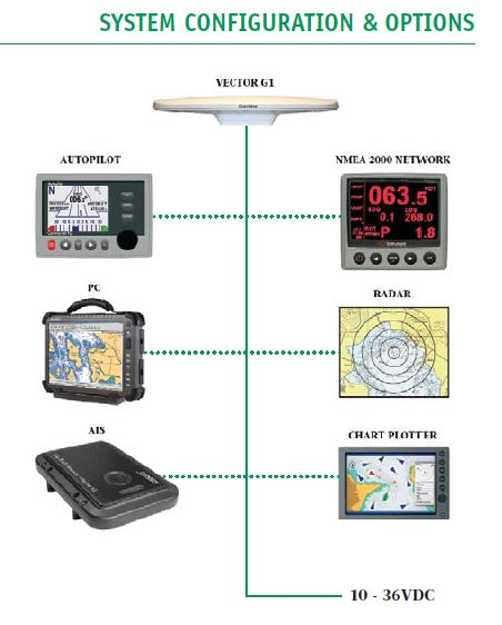
The G1 is a complete GPS compass and positioning system in a single enclosure that requires only one power/data cable connection. With its CAN support and ease of installation, the G1 is the perfect solution for both marine and land base applications such as mine construction, earthworks and machine guidance.
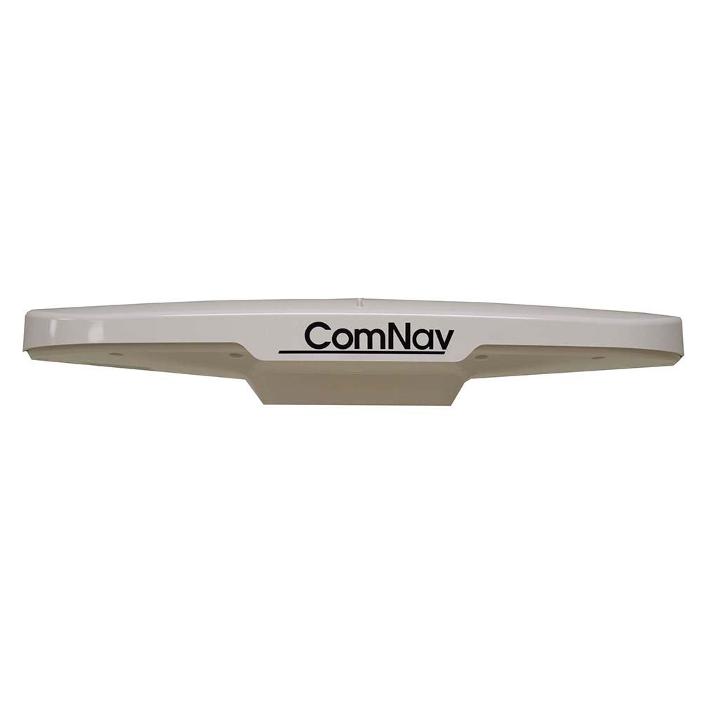
Small compact all-in-one maintenance free unit
- New: Supports both GPS and GLONASS satellites for complete redundancy
- New: Heading accuracy < 0.5° rms • New: Position accuracy < 1.0m 95% confidence (DGPS)
- New: An integrated 9 Axis Inertial Measurement Core (IMC technology) provides enhanced roll, tilt and heading stability even during momentary loss of satellite signals
- New: G3 color display system (optional)
- New: Engineered enhancements to exceed sealed IP67 rating
- New: Extended 2 year warranty
- NMEA 0183 and NMEA 2000® interface • Heave, Pitch, Roll and Rate of Turn as standard output
- Heading updates 1 to 20 Hz
- BAUD Rate selectable: 4800, 9600, 19200, 38400,115200
- Fully compatible with on board NMEA 0183 and NMEA 2000® RADAR, ECDIS, AIS, Cameras, SONAR, PC and Autopilots
- Compact integrated surface mounting and pole mount
- Pre-programmed default settings for Heading, Rate of Turn, Course over Ground, Lat/Long position, Time & Date
- 15 meter serial cable standard (30 meter optional)
- 6 meter NMEA 2000® Cable (Optional)
- CE certified for EMI and RFI immunity
ComNav G1 Specifications:
- Receiver Type: L1, C/A code, with carrier phase smoothing
- Channels: Two 32-channel parallel tracking GPS, GLONASS, SBAS
- Update Rate: Standard 10 Hz, Selectable up to 20 Hz (position and heading
- Horizontal Accuracy: < 0.5m 95% confidence (DGPS)* < 2.5m 95% confidence (autonomous, no SA)**
- Heading Accuracy: < 0.50° rms
- Pitch / Roll Accuracy: < 1° rms Heave Accuracy: < 30 cm rms
- Rate of Turn: 90º / sec max
- Start-up Time: < 60 sec typical
- Heading Fix: < 10 sec Satellite Reacquisition: < 1 sec
ComNav G1 Communications:
- 1 full duplex R2-232 and 1 full duplex RS-422
- Baud Rates: 4800 - 115200
- Correction I/O Protocol: RTCM SC-104
- Data I/O Protocol: NMEA 0183, NMEA 2000, CAN
- NMEA Heading Messages: $GPHDT, $HEHDT, $HEHDM, $GPROT,
- $GHEROT, $GPGGA, $GPGSV, $GPVTG, $GPRMC, $GPZDA, $PASHR
ComNav G1 Environmental:
- Operating Temperature: -30ºC to +70ºC (-22ºF to + 158ºF)
- Storage Temperature: -40ºC to +85ºC (-40ºF to + 185ºF)
- Humidity: 95% non-condensing
- EMC: FCC Part 1.5, Subpart B, Class B, CISPR22, CE
ComNav G1 Power:
- Input Voltage: 10 to 36 VDC
- Power Consumption: < 2.8 W nominal
- Current Consumption: < 240 mA @ 12 VDC
- Power Isolation: Power supply isolated from serial ports
- Reverse Polarity Protection: Yes
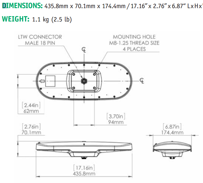
- Power/Data Connection: 18-pin female circular, IP67 sealed 15m cable
ComNav G1 Aiding Device:
- Gyro: Provides reliable < 1º Heading for up to 3 minutes when loss of GPS has occurred
- Tilt Sensor: Assists in fast start-up of heading solution
* Depends on multipath environment, number of satellites in view, satellite geometry, baseline length (for local services), and Ionospheric activity.
** Depends on multipath environment, number of satellites in view, and satellite geometry