
MAP Pricing - Add to cart for your special price.
Rose Point has stopped shipping DVDs with a purchase of their software. You now need to download it from their website. What we are providing is a software Product ID which when entered into the downloaded software unlocks it for your use. We will not be shipping any physical product to you anymore.
You can download the software here.
Coastal Explorer Navigation Software Product ID Key CEX-0110P - Rose Point Navigation
Coastal Explorer™ is a sophisticated, full-featured, easy-to-use navigation software package designed specifically for the pleasure boater.
With support for more charts and chart formats than any other recreational navigation system, advanced route planning features, integrated gazetteer and guide books, virtual instrument display, and obstacle alerts, Coastal Explorer will help you make your next cruise safer and more enjoyable.
Explore
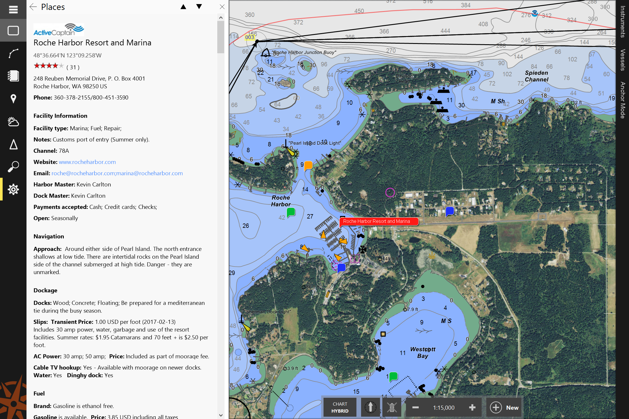
The gazetteer includes millions of places in the US, Canada, and Mexico and many more countries are available. You can find any of these places on the chart by simply entering a name into the Search box!
Guidebook information from ActiveCaptain and other sources is tightly integrated into Coastal Explorer’s charts. Sailing directions from the US Coast Pilot® are also included.
Plan
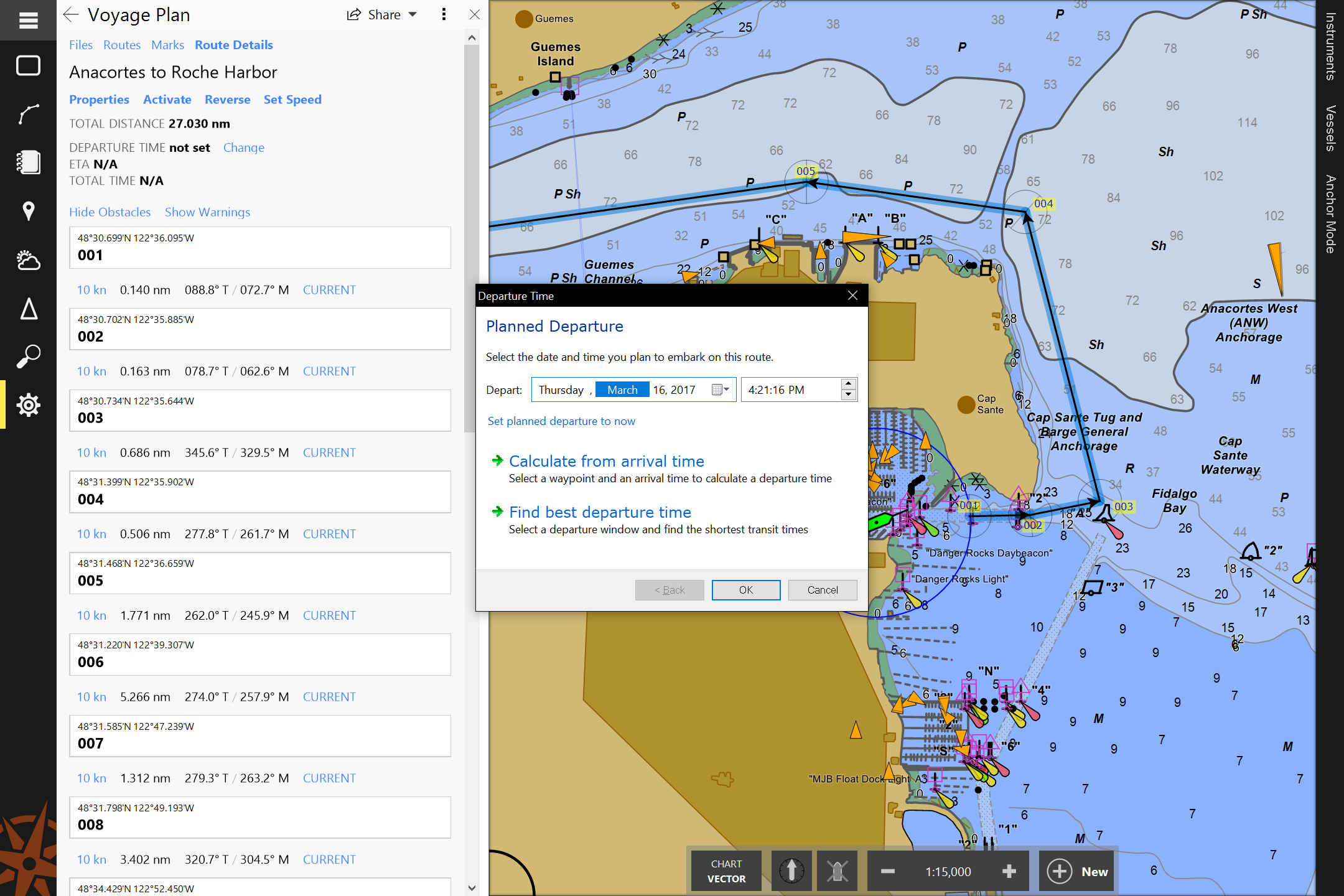
Coastal Explorer makes it easy to plan your next cruising adventure with features like multi-level undo, powerful route manipulation tools, and route obstacle detection.
Coastal Explorer uses documents instead of a hidden database to keep track of all of your routes, waypoints, boundary areas, and other marks so you can organize them however you want. You can even share them with your friends using email or a USB Flash Drive!
Prepare
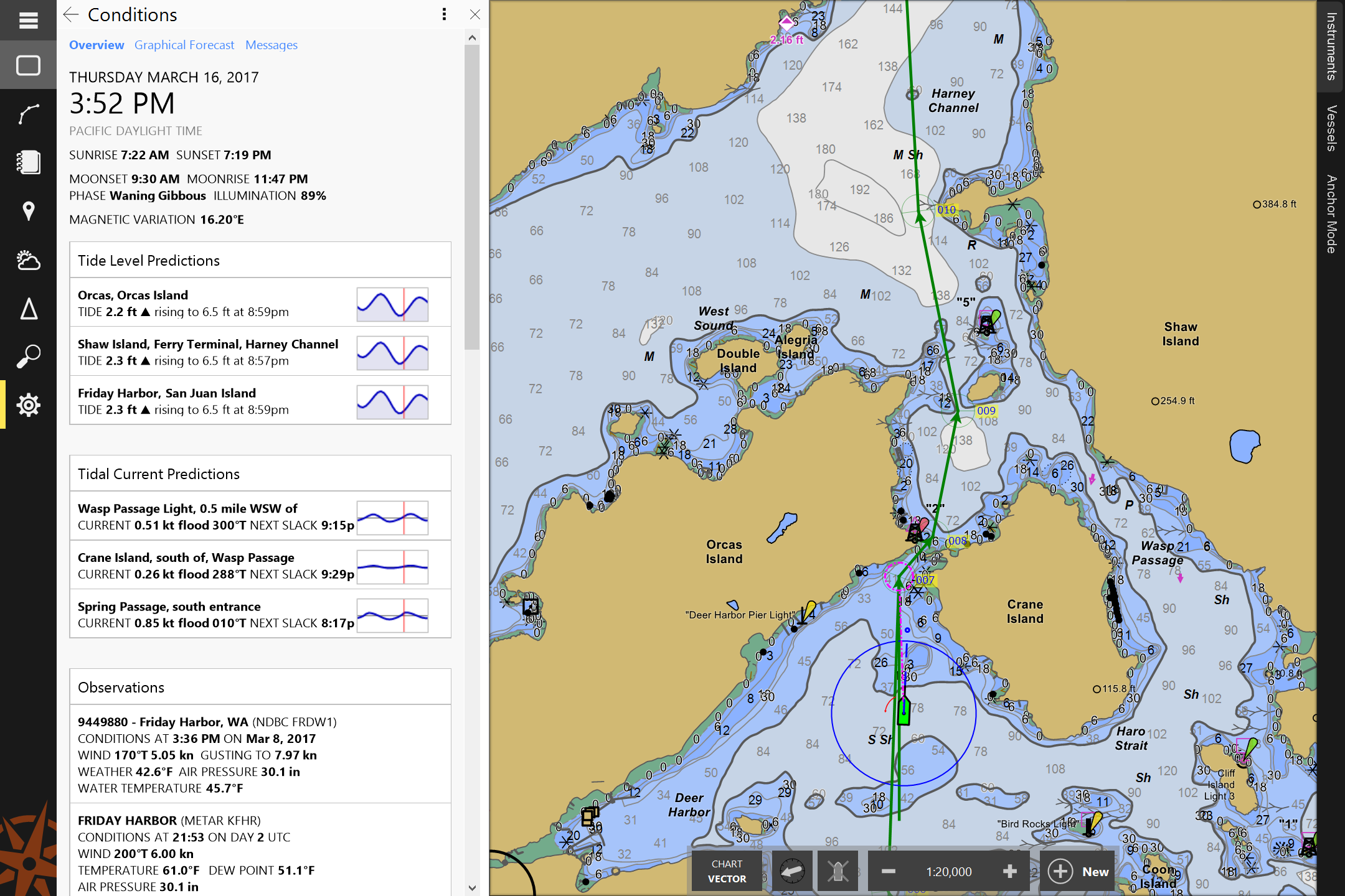
Coastal Explorer can predict tide levels and tidal currents at all official US stations. Predictions for other countries are also available in some chart products. Tide predictions are presented in easy to read graphs along with daily high, low, and slack water times.
Weather forecasts are presented in both text and graphical formats and are easily downloaded when you have internet access. Current weather conditions are also displayed when available.
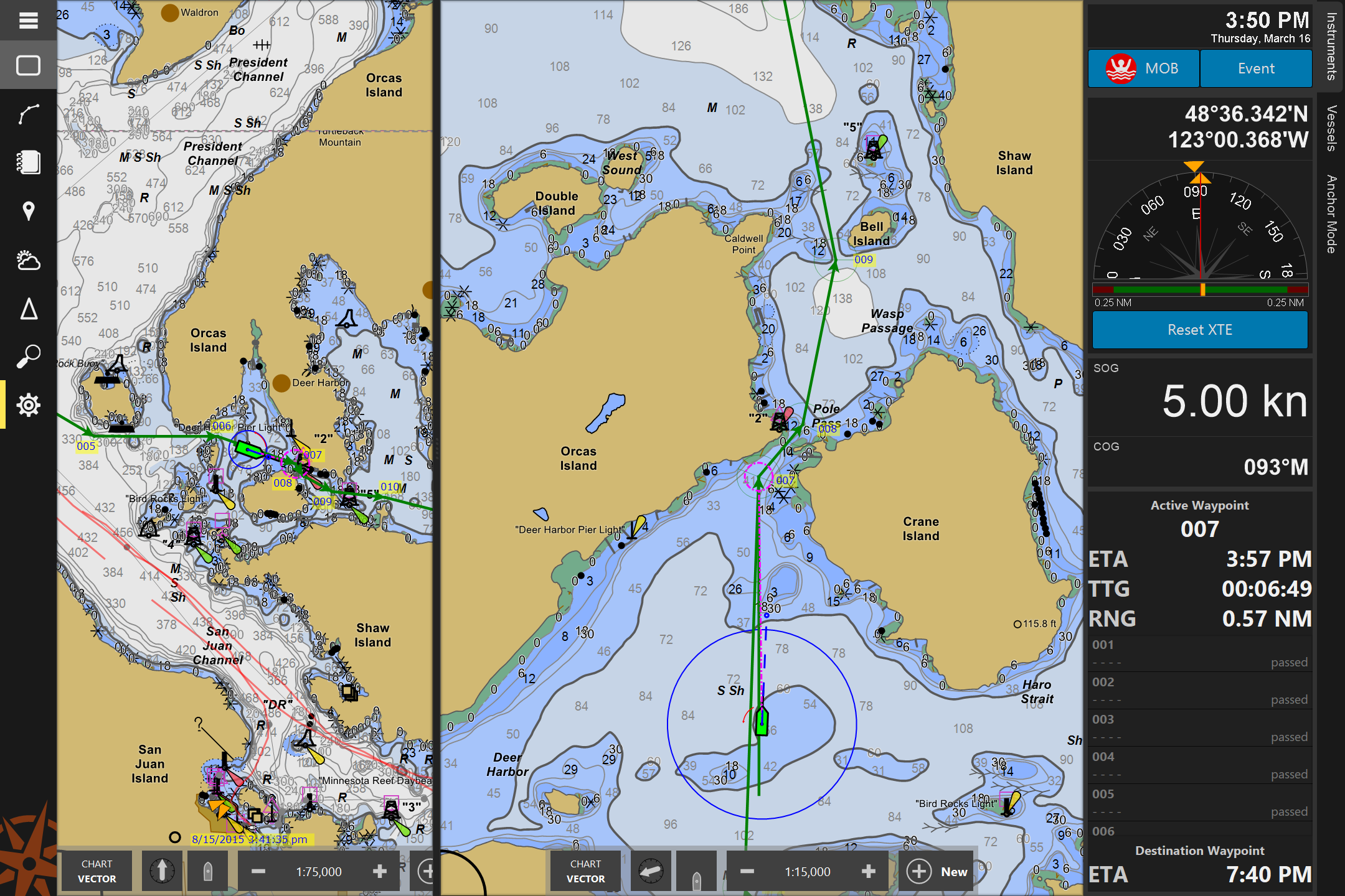
Navigate
Split the screen into two, three, or four charts with a single key or button press. There’s no need to resize or rearrange windows; Coastal Explorer takes care of it for you!
Orient the chart with North Up, Heading Up, or Course Up and let Coastal Explorer automatically scroll the chart to keep your boat centered or near the edge so you can see more of what’s ahead.
Voice Alerts are used to warn you of waypoint arrivals, depths out of range, and even charted obstacles along your path!
Virtual Instrument panels show you information from your electronics in large, easy to see displays. Coastal Explorer includes an analog compass with waypoint arrow, analog wind, cross track error, and rudder angle displays, depth and temperature graphs, and many digital display options.
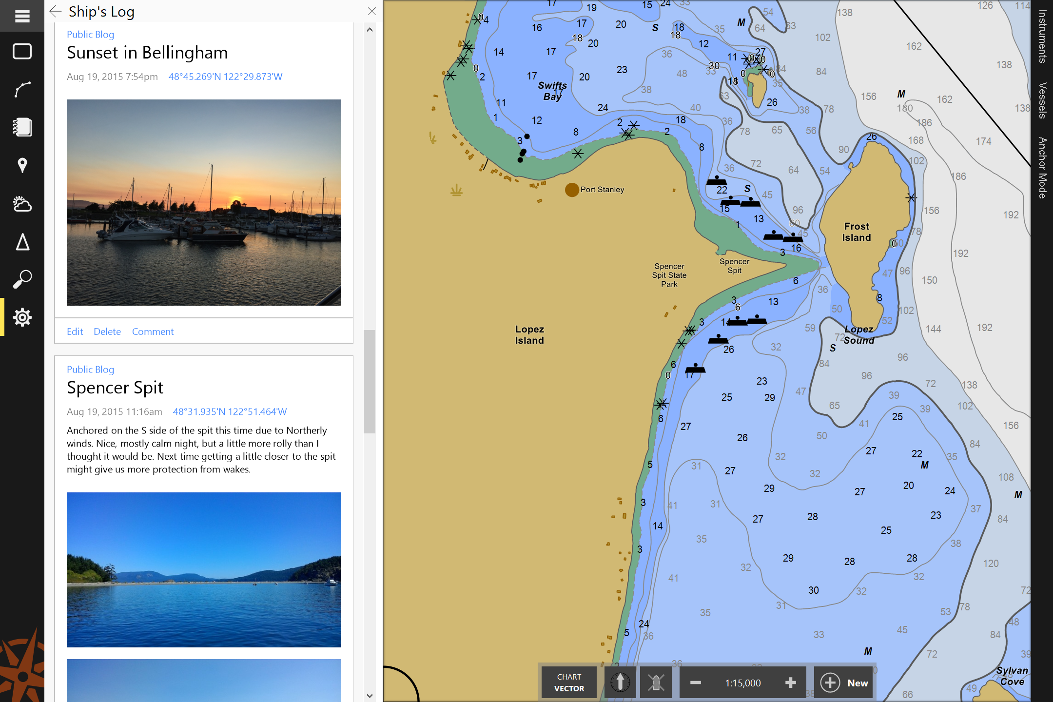
Remember
Use the Ship’s Log to keep track of your voyages and even share them with friends and family back home. Coastal Explorer provides you with three separate log books; one for notes, one that’s private, and one that you can share as a “blog” on the internet.
Charts
Coastal Explorer lets you choose the types of charts you want to use from Rose Point, NOAA, the US Army Corps of Engineers, Canadian Hydrographic Services, C-MAP, and more.
A complete set of US Charts in both raster and vector formats is included, and Coastal Explorer helps you keep your charts up-to-date by automatically downloading updates when they are available.
With chart quilting, there’s no need to figure out which charts to open. Just zoom in, out and scroll and the right charts will appear seamlessly quilted together.
Interface Options
Coastal Explorer can use and display information from your GPS, heading sensor, depth sounder, autopilot, water speed and temperature sensors, wind and weather instruments, RADAR, and AIS receiver. Most NMEA 0183 and NMEA 2000® interfaces are supported.
Specifications
Features
|
Chart Compatibility
Device CompatibilityInterfaces
VIDEO INPUT
NAVTEX INTERFACES
System Requirements
|